May be because I live and have lived in the plains and plateaus all my life, but I am in awe of the mountains. I crave everything about them – their sheer vastness, their dizzy heights, the pleasant weather in their valleys, the raw strength of their ragged rocks, the greenery of their landscape, the variety of their flora, the imperiousness of their tall trees that dot their surface and scream of free spirit, and the busy noises from their habitats that for a change are not dominated by the man made devices but emanate from a life evolved out of their own unique ecosystem.
Whether they are semi-valid reasons or thinly veiled excuses for my laziness, I found ways to miss those drives, those treks and the hikes across mountains that I used to do frequently up until a few years ago. Perhaps with friends graduating to parents and now nurturing toddlers of their own and rightfully adjusting their priorities, these trips that I used to take for granted once are almost impossible to coordinate and pull off now-a-days. So, with a long weekend around the corner, I decided to take a few days off and make a trip on my own through the entire Blue Ridge Parkway and the Skyline drive.
The Blue Ridge Parkway is a designated recreational motor road, linking Great Smoky Mountains and Shenandoah National Parks and he Skyline drive is the adjoining drive along the mountain skyline through Shanandoah National Parks. The Blue Ridge parkway stretches through North Carilina/Tennesse border in the south into Virginia in the north over a distance of 469 miles and merges with Skyline drive for another 105 miles. I drove through parts of the parkway and the Skyline drive with friends and parents a couple of times before, but never alone on my own and never the entire distance.
The idea of total creative freedom by retaining the intellectual property rights for the uninfluenced choice of activities during the lonely trip seemed far too inviting even against the downside of having no one to share it with. It sounds like no big deal, but I guess you’d have to be a borderline sociopath (not me) or something of an anti-social loner (like me) to actually enjoy doing it alone. Once the thought crossed my mind, it felt like a no-brainer and I couldn’t wait to hit the road. I took a few days off to coincide with the long weekend and set out on my trip.
Just to keep it more interesting and challenging, I set myself a couple of self-imposed rules:
1. I intentionally didn’t write down even a single piece of information on any paper. If Steve Jobs is right, and his IPhone is really that cool, I should be able to pull out any information I want from my IPhone and what if I am stranded in the middle of a forest with no AT&T service? Well, I wanted to find out. After all, if I am going to be reclusive about this, I should afford myself these risks, even if it sounds stupid. Also, I wanted to try out the GPS capabilities of the IPhone without spending the $9.99 monthly services from AT&T which could have made my IPhone a true GPS device with voice activated directions and all. Also, sticking with the IPhone theme, I didn’t carry another camera, just whatever snaps I could take from the IPhone had to suffice. All the pictures posted here are from my IPhone, so the quality isn’t terrible, but not top notch. I did make some tentative reservations for three nights, one night each at the southern tip of the parkway (Cherokee, NC), at a tentative half-way point (Floyd, VA), and around the northern tip of the parkway (Winchester, VA).
2. I had to stick to the Parkway the entire way – no ifs and buts! In other words, if it was getting dark and I’m not making enough time through the parkway, I cannot exit out of the parkway and get through a few miles quickly on a freeway or a highway to get to one of those reserved hotels, because if I afforded that luxury, I wouldn’t travel through every mile post of the parkway, which was my main objective.
Sep. 2, 2009 – 01:30 AM (Cherokee, NC):
Southern tip of Blue Ridge Parkway
Phew, I finally made it to the hotel! What if it only took 3.5 hours more than anticipated. I couldn’t have asked for a better travel weather. I didn’t have to turn the AC on in the car at any point during the 12 hour drive to Cherokee, but it is still took 3 hours more than anticipated. I was able to get to Pigeon Forge, TN in anticipated time. The southern tip of the Blue Ridge parkway actually falls within the Smoky Mountain National Park and Pigeon Forge is one of the entry points to the Smoky Mountains, and is actually a pleasant little town with tons of activities and festivities for the travelers. I remember driving through the same town on one of my previous hiking trips to the Smokies with friends a few years ago. I saw lot of families with kids on the on the sidewalks enjoying the night as I drove through the town. The directions to the hotel I reserved for my overnight stay in Cherokee required me to drive through Pigeon Forge and cut across the Park along US-441 to get to Cherokee valley. It was after 9:00 pm in the night, and if things went as anticipated I could have arrived in Cherokee by 10:00 pm.
As I crossed Pigeon Forge and entered the Smoky Mountain National Forest in pitch dark, along US-441, I saw flashing red and blue lights on top of a park ranger’s car in front of me blocking US-441. Apparently, they have an event the next morning in the Smoky Mountains for which they had to block the road through the parkway and I had no alternative but to find an alternate route. The friendly ranger was kind enough to suggest what she thought was my best option to get to Cherokee and quickly proceeded to spit out a series of lefts and rights from Pigeon Forge to a highway from where I can supposedly find the exit to Cherokee. I nodded as if I understood and decided to put the great IPhone to use instead. I couldn’t get any service inside the park, so I drove back to Pigeon Forge and breathed a sigh of relief to see it pick up my mobile service. It was getting late and I was tired, so I got some food from a fast food place and retrieved an alternate route as I finished eating it. Instead of US-441, I had to take US-321 to US-40 to US-19 to Cherokee. After another 2+ hours of driving through the forest in the night on these roads, I reached Cherokee. Note to self about truckers driving in these parts – they are insane! I don’t like to generalize, but I have to question their sanity when truck after truck tries to drive just as fast or faster and get into speed races with the cars and vans on the highways, never mind the cargo of automobiles they are carrying in the trailers behind them and the blind spirals they have to navigate in front of them!Cherokee is an American Indian reservation and has a casino right in the middle of the town. I was able to get to the Casino, but the road on which the hotel resides was blocked for construction and by the time I figured out yet another re-route within Cherokee and got to the hotel, it was past midnight. Along the way, I noticed a few American Indian girls (dressed up as Casino dealers) walking back home after what I presume was their work in the Casino, which must be the main attraction for anyone to come to Cherokee. I don’t think there are many who come to Cherokee to start their Blue Ridge parkway trip. Pigeon Forge or Gatlinburg in neighboring Tennessee border, is much more of a popular choice for the Smoky Mountain attractions.Not for the first time, I noticed somewhat of a resemblance in the British accent and the Southern accent when I spoke with the lady at the front desk. Say what you want about the American South, everyone I’ve ever met in the South has been polite, friendly and spoke with a genuine smile on their face. The lady at the front desk blessed my heart for being able to make it in spite of US-441 getting blocked and sent me along to my room. It is past 1:30 now and while I was hoping to get up around 6:00 to get to the Blue Ridge entrance by 7:00 am, I am doubtful if I will be able to get up in time for that. I may have to revisit that plan in the morning. With all the driving I did and I was going to do, the last thing I can afford is sleep deprivation.
Sep. 2, 2009 – 03:00 PM (Blue Ridge Parkway : Milestone 380 near Ashville, NC):
As expected, I got up late, much later than my original 6:00 am plan, which was wishful thinking anyway. By the time I got some coffee, packed up and checked out, it was 10:30 am. After some stumbling around to find the entrance, I entered the Blue Ridge Parkway at 11:00 am. There is no fee to drive the Blue Ridge parkway.
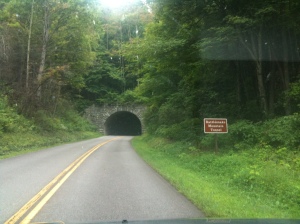
Surprisingly, I encountered very few visitors traveling either way until later in the day, which was just fine by me. It was still quite foggy without the sun fully out when I entered the parkway which still had an early morning freshness to it. I drove through the first of many tunnels built along the drive. It started raining, but like the fleeting weather in these mountains, it lasted only for a brief period. The southern part of the parkway is at a higher elevation than the northern part. I stopped at the first of the many overlooks with a view of the aptly named Smoky Mountains looking like a chimney working overtime. The fog cleared up in half an hour as the sun came out and the views from the overlooks became clearer, but the fog and the mist had its own charm while they lasted.
Other than a couple of cars going the other way, still not many drivers. They started
trickling in after noon. Blue Ridge Parkway is a hot spot for the bike riders, because of its steep and curvy roads, up and down the mountains that offer them somewhat of a thrill ride in a scenic setup. I saw more and more of them as the day grew older. Below is a picture of a biker who drove a long distance like myself and noticing I was driving alone, offered to take my picture against the backdrop, and ended up taking hers first as she had the camera pointed the other way. I really like her picture and liked her spirit..indeed age is no barrier to how young you are at heart!
I reached the Visitor Center at milepost 380 by 2:00 pm. In speaking with the visitor center folks, they thought it was best if I filled gas in Ashville right off the parkway there. So, I filled gas
and brought more fast food back to the fine Visitor Center area to finish these notes while finishing my late lunch. The parking lot is full of cars here. Ashville is one of the bigger towns in NC and more people enter the parkway here than at Cherokee. Also, I see some people who enter the parkway here for a jog and a good workout.
Because of the proximity to Ashville, the mobile service was strong. I pulled up the information of the hotel I booked in Floyd, VA from my email and called them to cancel it. Judging by the distance I made, if I make it to Floyd overnight, it was going to be really late. I was told that there’s plenty of availability if I do get there later tonight. I collected some parkway information material at the visitor center and looked up the trails along the way and decided to do one of the “severe” hikes though I am not really in that good a shape physically – I can’t wimp out now!
Sep 3, 2009 – 00:20 AM (Floyd, VA):
I did make it to Floyd after all, albeit very late. Floyd is a sleepy little Virginia town off the parkway at milepost 165. If I didn’t make up this distance now, I would have left myself having to cover it tomorrow and with the Skyline drive looming where I knew there are many more overlooks and speed limit is lowered to 35 mph, it would have forced me to spend an extra day somewhere for this trip and I wanted to avoid that extra expenditure.Rough Ridge overlook is near milepost 303, and I stopped here for my hike. I
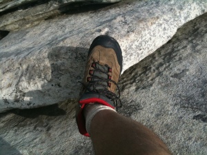
followed the trail upward from the parking lot and took left along the Tanawha Trail on to the board walk and a steep climb up the rocks to some superb birds-eye views off the protruding rocks along the hike. I ran into a couple of seasoned hikers during this and later learnt that I picked the right trail and it is as good a trail as there is one along the parkway. Apparently, the number of visitors to the parkway has been decreasing over the years and it was evident from the sparse crowds. Maybe the weekends bring in more people, but this was just perfect for me. I reached the summit
somewhat huffing and puffing and spent more than half an hour there soaking in the
unbelievable view of the mountain ranges from atop. This is the best part of the hike. The high of reaching the summit with somewhat tired legs and just absorbing the sunlight and looking all around me at the green peaks and valleys gave me a feeling of being given a 360 degree view from a first class seat on one of those white clouds floating around. The views are breathtaking and the experience within is one of a feeling of an exhilarating high, as high as some of these mountain peaks themselves, even if you are not sharing it with anyone. If this is the experience of a mere hike along a public trail in a National Parkway, I understand the addiction the mountain climbers have to attempting to reach the summits of some ofworld’s tallest peaks such as Mount K2 and Mount Everest, and this brings back
memories of primary school days when our Social Science teacher had a tough time giving a convincing answer to one of the student’s questions about why do mountain climbers risk their lives and go to extreme lengths to ascend such dangerous peaks. For those climbers, it must be difficult to explain, but easy to experience. As I climbed down to the parking lot, a much easier task, I made a mental note of coming back to this trail the next time I returned to the parkway. I caught up with somewhat of an older couple who went only as far as the board walk took them which still provided a great view and were climbing down from there. Back at the parking lot, they requested with a grin that I take their picture there so they can tell people that they were there. As I obliged, I couldn’t help but feel fortunate in many ways and how little time we all have to truly experience these nature’s gifts.
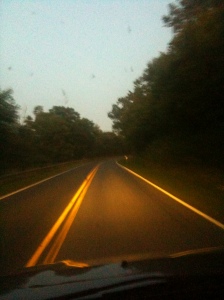
After that spectacular hike which took up a couple of hours and into the evening dusk, I sped through the rest of the way intent on making up as much ground as I can to Floyd. I managed to take a couple of snaps on the fly even as I ran through the pretty scenery of rolling hills with green meadows with picket-fenced horse farms with grazing horses in evening sunlight. As the sunlight disappeared, the mist reappeared
and though it was almost a full moon, visibility was tough, and coupled with young deer constantly venturing onto the road at twilight, it was risky driving. I had to veer away from transfixed deer on the road with that “deer-in-the-headlight-look” on at least three occasions I can remember. The mobile service was dead again and I got to Floyd purely relying on scant directions available from the map I got from the Visitors Center. Once I got here, I filled in gas and asked for directions to the hotel which was right adjacent to the gas station. I arrived just within the closing time of the hotel office. The room far exceeded my expectations; it was surprisingly spacious, very clean and tidy, had all the amenities I needed, including wifi connection just like in Cherokee. Clearly, wireless and internet infrastructure has caught up with even remote parts of the country, and while I couldn’t find an open restaurant after 10:00 pm in town and ended up savoring granola bars from the hotel vending machine for the night, I had no problems catching up with my email and all communications via my IPhone, even though AT&T mobile service was still dead. Yes, the Information Revolution is alive and well!
Sep 3, 2009 – 04:30 PM (Blue Ridge Parkway : Milestone 5 near Waynesboro, VA):
I had a good night’s sleep in Floyd and picked up some breakfast at yet another local
fast food place on my way to the Parkway after checking out from the hotel. I couldn’t afford too many breaks on the way if I wanted to reach my pre-planned destination of Winchester, VA and finish my last leg of my three-legged trip. So, I ate my breakfast while driving.
Trail’s Cabin was a cabin protected with fencing (picture) at one of the overlooks along the way. Built by Trail family in 1890s, it gives an idea of a typical log buildings built by the pioneers of the country in forested areas during those times. How about that backdrop and that backyard!This is also a stretch where you see posts at many picnic area along he parkway asking
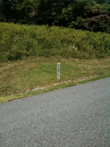
you to protect your food as it is bear country, though I didn’t see any bears during this stretch I saw plenty of deer and wild fowls. There are wooden milepost markers posted every mile (such as this one in the picture) which is also a throwback to yester years to give you an idea of where you are in the parkway, though it can get difficult to catch it once it gets dark and you want to know where you are to take a proper exit.
I took the Roanoke mountain trip, a five mile drive off the parkway and back into the parkway, up the Roanoke mountain that has a couple of goodoverlooks to the city of Roanoke.
I stopped at Bald Mountain Overlook where the elevation was one of the highest in the northern part of the parkway, but is also a stretch of long treeless patches on the mountain top. ItRoanoke from atop Roanoke mountain (click to view)
gives a different perspective and an opportunity to stretch your legs and soak the sun in. Here are a few snaps from there.
I am writing these notes at Milestone 6, from the Humpback Gap parking area where I just finished a 2 mile stretch of the Appalachian trail to Humpback Mountain and back to the parking area – a more tiring and strenuous hike than the Rough Ridge trail yesterday. Most of this trail goes through parts of the famous Appalachian Trail, a trail that stretchesall the way to Maine through the forests of the Appalachian mountain ranges, but it was an equally rewarding effort.
I am nearing the end of the Blue Ridge Parkway and am left with covering the Skyline drive inthe remaining time, with a hope that I don’t have to drive long stretches in the night through the fabulous Shannadoah National park.
Sep 4, 2009 – 00:30 AM (Winchester, VA):
I finished my Blue Ridge parkway trip and reached my hotel I made the reservations with in
Winchester, VA after a fantastic final stretch through the Skyline Drive. Of the three places I ended up spending the nights during my trip (Cherokee, Floyd, and Winchester), Winchester is a larger town with a University, a community college, a mall, and a slew of restaurants beyond the fast food chains. I knew I hit civilization when I called the hotel for directions because the hotel location mapped out to a wrong address on my IPhone maps and the girl at the other end asked me what the GPS system I might be be using is telling me about my current whereabouts. When I tried to explain to her that I don’t carry a GPS system and that I had the address, but it maps to a different location on my phone,
she went on to explain that a GPS system will usually tell me when I reached the destination. She was very polite and helpful, but sensing a hint of suppressed frustration at her perception of my lack of technology savvy (what human being in America travels without a GPS system now-a-days? Ew?), I just asked her directions from a nearby highway and was able to get there within the next half an hour.
As the Blue Ridge parkway ends, it merges with the Skyline drive. There is a fee of $15 at the entrance to the Skyline drive, and it is worth it. As the name suggests, the Skyline Drive ranges through the skyline of the mountain ranges into the Shanandoah valley and finishes near Front Royal, VA (if going from South to North). The overlooks and the views from the drive are just stunning. Unfortunately, due to fading sunlight and as I was running out of time, Ididn’t take many snapshots during the drive, but due to the timing of my drive, I was
able to witness the sunset within the mountains and the beauty of moonlight on a near full moon. The snaps here don’t do justice to the true beauty of this place. As you are driving northwest along the Skyline drive, you can witness the sun set into the skyline of the mountain ranges on one side and the moon rise to softly light up the gaps and valleys on the other side, simultaneously!! I also witnessed a black bear cub (couldn’t take the picture in time), avoided yet another collision with the deer, and wore out the breaks of my car as it wound through the top of the mountain ranges along the skyline. My only regret of this trip is not being able to spend enough time here. Next time, I intend to spend a whole day just through the Skyline drive. Even in the fading sunlight, there were a lot more visitors to the park here along with enthusiastic hikers and bikers.
Overall, the trip far exceeded my expectations and I was extremely glad I decided to proceed with it. Off to bed after yet another fast food dinner. A quick off topic note about fast food chains and the general negative perception surrounding them – they are a blessing during trips like mine; you can expect one to be present even in the most remote of locations, you know what you are getting, they are available late now-a-days and best of all, the service is fast and on the go, exactly what I wanted. So thank you McDonalds, Hardees, Subway and Quiznos! I intend to sleep late into the morning tomorrow, before my long drive back home.











 . > my videos
 .. > my photos
 .. > my poems
 .. > my sh. stories
 … > my critique
 … > my travelogue
 …. > my markers
 A Dram of Poison – Charlotte Armstrong (1957)